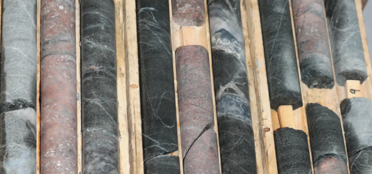
Goldflare Exploration’s Condor gold property is located 35 km northeast of Rouyn-Noranda, extending east along the Porcupine-Destor fault, a key geological feature. This site hosts one of the largest alkaline syenite intrusions in the Abitibi Belt, offering untapped gold potential based on the discovery of new surface gold showings and a drilling result of 1 g/t over 7 meters. The property also has copper potential, based on the sporadic presence of chalcopyrite and a mineralization model similar to that of Upper Beaver in Ontario. These new elements position Condor as a strategic project with high volume and discovery potential.
Projects
Syenite Condor

Introduction
Property Features
- Geographic Location:
- 35 km northeast of Rouyn-Noranda, Quebec.
- Area:
- 657.52 (ha)
- Access and Infrastructure:
- Easy access via the road network, with nearby accommodation and services.
- Proximity to Other Deposits:
- Near IAMGOLD's Fayolle mine and the Westwood mine area.
Geology and Exploration Potential
- The project is located along the Porcupine-Destor fault, marked by the intersection of several northwest-southeast faults.
- Gold alteration has been identified in syenite and lamprophyre intrusions, characterized by strong hematization associated with carbonates and pyrite. Mineralization is also related to magmatic breccia and fracturing zones.
- A series of recent drill holes has revealed significant results, notably at Condor-1, Condor-2, and Condor-3.
Exploration History and Results
Initial Discovery
A surface showing was discovered in 2017 during a prospecting campaign. Follow-up work uncovered a mineralized block about 1 km east of the initial discovery. Subsequent prospecting and stripping revealed a complex mineralized structure covering several tens of meters at surface.
Condor-1 Extension
Drilling has extended the Condor-1 mineralization about 500 meters to the north-northwest. The mineralized structure is open in all directions.
Drilling Programs
Several drill holes confirmed the presence of a large gold system controlled by a series of breccias and fractures that can be traced for about 2 km, associated with lamprophyre dykes.
Nearby Properties and Mines
Macassa Mine (1933-1999, resumed in 2002-present): Located in Kirkland Lake, Ontario, Macassa is one of the richest gold mines globally, with a cumulative production of over 6 million ounces. In 2023, it produced 228,535 ounces of gold (Agnico Eagle – Macassa, 2024).
West Timmins Mine (2012-present): Located about 18 km west of Timmins, Ontario, this underground mine exploits three gold deposits associated with alkaline intrusions like lamprophyres and syenites: Timmins, Thunder Creek, and 144 Gap. Since 2016, the operation has produced about 809,360 ounces (panaemericansilver.com).
Objectives and Next Steps
- A systematic exploration approach to cover the land thoroughly, using soil geochemistry and geophysical tools to identify the most promising targets for exploration.
- Continued drilling to deepen exploration of already identified targets based on preliminary work.
- Validating the continuity of mineralization across the property using basic exploration methods to confirm the extent of mineralized zones.
- Developing a comprehensive geological model by integrating all collected data to improve land understanding and optimize future exploration campaigns.
*The technical information contained in this presentation has been verified by Martin Demers, geologist (OGQ 770), a qualified person under NI43-101 standards.