Projects

Duplessis-Agar

Introduction

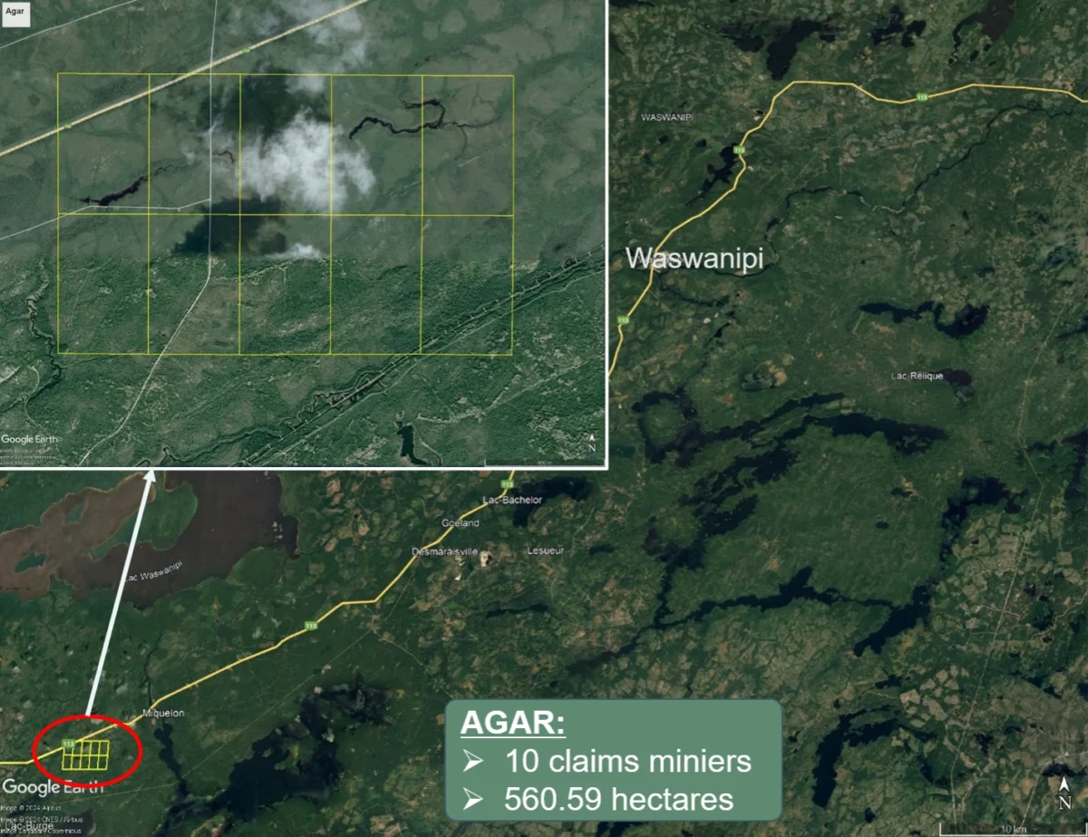
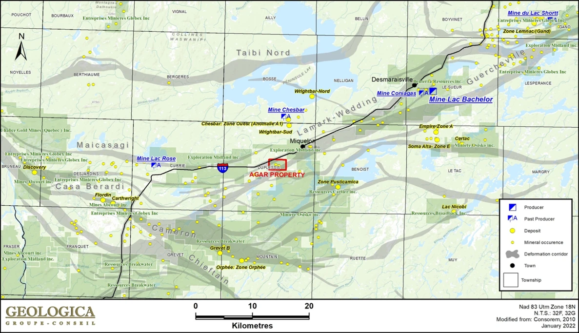
Acquired from Breakwater Resources in 2021, Goldflare Exploration’s Agar property is located in the Abitibi region of Quebec, 215 km east-northeast of Val-d’Or and 61 km north-east of Lebel-sur-Quévillon in the Duplessis Township. The property covers 560.59 hectares and benefits from a strategic proximity to several notable mines and mining projects, enhancing its gold potential.

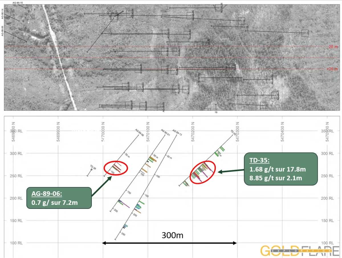
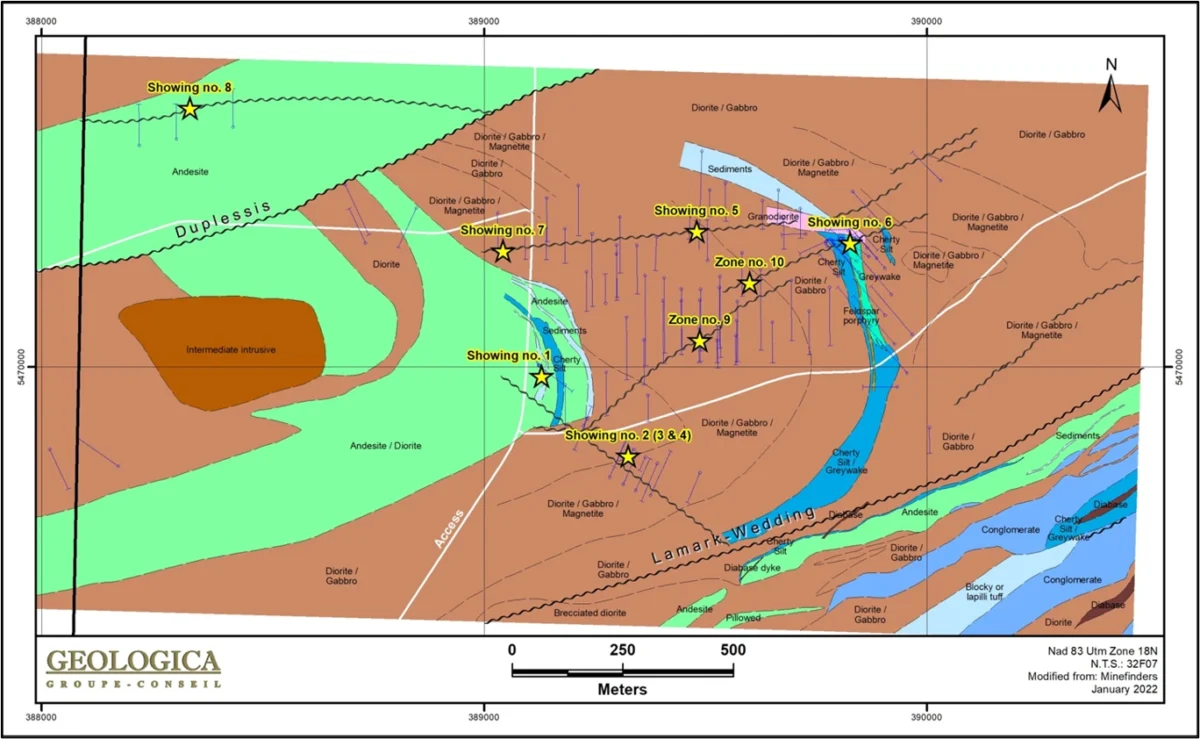
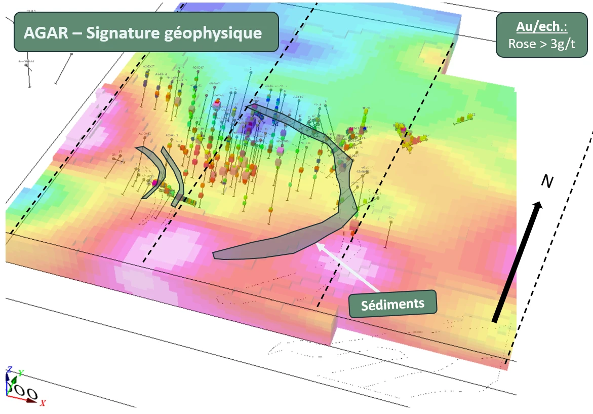
With historical drilling results, such as 4.24 g/t over 5.99 meters and 2.84 g/t over 9.50 meters, the property has already shown significant exploration potential. In addition to mineralized areas identified within a corridor approximately 500 meters wide appearing in a gabbro mass, new targets are being explored based on new electromagnetic data, paving the way for promising future exploration. A 2% NSR royalty is attached to the property titles. Agar thus represents a key project, crossed by a regional road, ready to maximize its discovery potential and play a strategic role in the company’s mining portfolio.

Property Features

Geographic Location:
215 km from Val-d'Or and 61 km from Lebel-sur-Quévillon in Duplessis Township, Quebec.
Area:
560.59 (ha)
Access and Infrastructure:
Access via routes 117 and 113, followed by forest roads. Regional airports in Val-d'Or and Lebel-sur-Quévillon provide air access.
Environment:
The property is located in a region characterized by moderate elevation and shallow surface deposits.

Geology and Exploration Potential

  • Mineralization: Gold showings are associated with networked quartz veins, silicification zones, and disseminated pyrite.
  • Host Rocks: Gabbro or diorite, near sedimentary contacts.
  • Deformation Corridors: Two sub-parallel deformation corridors oriented northeast: Duplessis to the north and Lamark-Wedding to the south.
  • Fold Hinge: Presence of a kilometer-scale fold hinge located between the deformation corridors, which appears to control the mineralization.
  • A series of historical drillings on the Agar property revealed significant results, including drill holes with intersections of 5.8 g/t Au over 5.10 m, 6.8 g/t Au over 4.50 m.

Exploration History and Results

  • Further Exploration: Since the 1940s, several exploration campaigns have been conducted on the property. Drilling revealed multiple gold-bearing zones, notably at the Lac Burge-Nord showing, with results of 6.90 g/t Au over 2.30 meters.
  • Acquisition and Drilling: In 1983, Mindefinders acquired the Agar property and completed about 60 drill holes totalling 10,738 meters between 1987 and 1990. These efforts identified seven mineralized showings on the property.

Nearby Properties and Mines

  • Bachelor Mine (1982-1989): This mine produced approximately 130,341 ounces of gold.
  • Langlois Mine (2015): In 2015, the Langlois mine, located about 25 km south of the Agar project, extracted 1,900 ounces of gold, 39,900 tonnes of zinc concentrate, 2,100 tonnes of copper concentrate, and 642,000 ounces of silver (Sigeom).
  • Coniagas Mine (1964-1972): This mine produced approximately 718,465 tonnes of ore, with an average silver grade of 183 g/t, as well as zinc (10.8%) (Sigeom).
  • Lac Shortt Mine (1935-1992): Located about 60 km north of the Agar project, the total gold production from this mine is estimated at 432,430 ounces (Sigeom).
  • These historical mines demonstrate the gold potential along the structural corridors hosting the Agar showings, as well as the presence of other metals like copper, zinc, and silver, which strengthens the appeal of the Agar property for future exploration.

Objectives and Next Steps

  • Phase 1: Surface work, primarily consisting of soil geochemical surveys and bulk sampling, will be carried out to target high-potential areas on the claims. These activities will be accompanied by electromagnetic surveys to assess the extensions of known mineralized zones, providing better direction for future drilling.
  • Phase 2: Definition drilling to explore newly identified mineralized targets and carry out 3D modelling of the identified zones.

*The technical information contained in this presentation has been verified by Martin Demers, geologist (OGQ 770), a qualified person under NI43-101 standards.

Image gallery